The North Cornwall Railway
WADEBRIDGE since closure
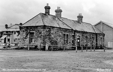 |
Although Wadebridge remained open, for traffic from Bodmin, for
longer than the rest of the line, modern development has now almost eliminated
the railway from the town. One very prominent structure that remains, however,
is the station building, which was looking rather worse for wear when
photographed by Ron Strutt in 1985. |
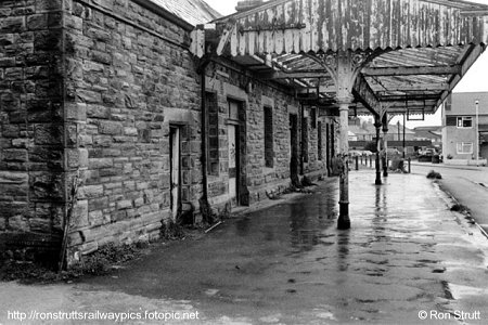
| The platform side, photographed once more by Ron Strutt,
showing the dilapidated state of the canopy and the new housing development
that swallowed up much of the station area. |
 |
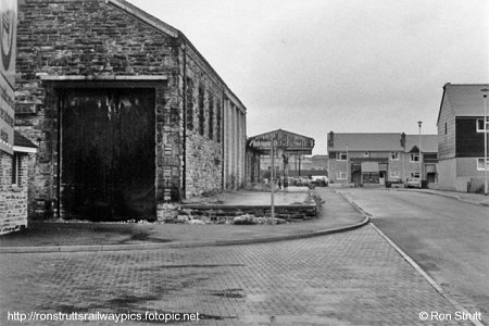 |
A longer distance view of the platform side with the old goods
shed, another survivor, in the foreground. Photographed by Ron Strutt in
1985. |
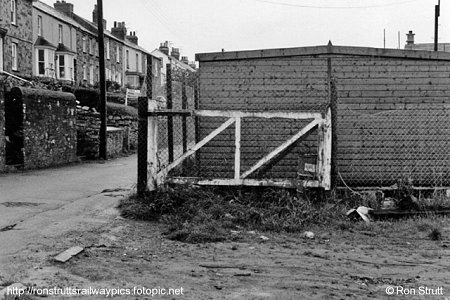
| The remains of Guineaport level crossing, by Wadebridge East
Signalbox, photographed by Ron Strutt in 1985. |
 |
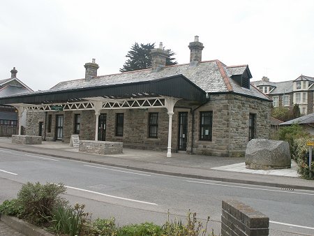 |
Photographed here in 2005, the station building is now in stark
contrast to the photograph above as it has been renovated and now enjoys a
second career as the Sir John Betjeman Centre for the elderly. |
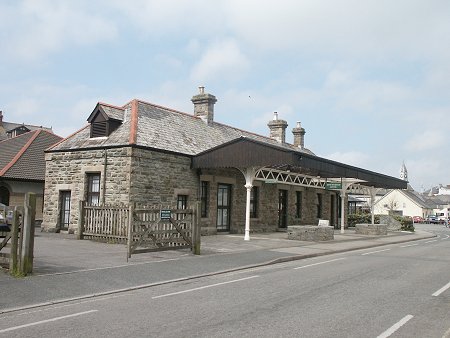
| Another view of the old station building showing how well looked
after it has been in recent years. Sir John had close ties with this part of
Cornwall, and had a house at nearby Rock where he is buried in St Enodoc's
churchyard. |
 |
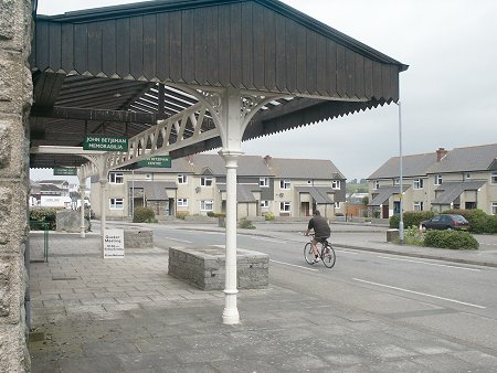 |
A view looking across the station site towards where the
locomotive servicing facilities and turntable once stood (beyond the houses on
the left and now a car park). Either side of Wadebridge the old trackbed has
been turned into The Camel Trail, which attracts thousands of walkers and
cyclists each week during the holiday season. The road here, called
appropriately enough "Southern Way", is part of the link through the
town that connects the two parts of the trail. |
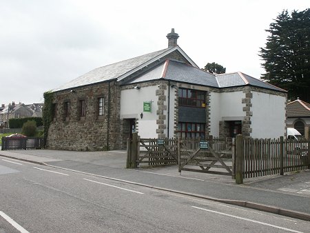
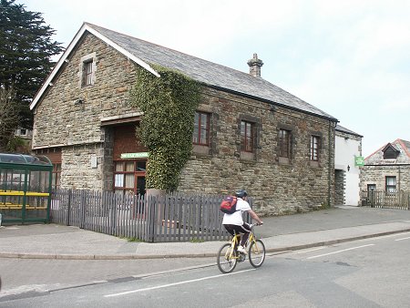
| The other survivor from the station buildings is the goods shed.
With vegetation growing up one corner in this 2005 view, and an extension on
the near end, this is now a Youth Centre. |
 |
 |
Another view of the old goods shed, and another cyclist passing
by! This end of the shed was probably the most photographed, drawn and painted
with, usually, a Beattie Well Tank and a short rake of goods wagons emerging
from the doorway. |
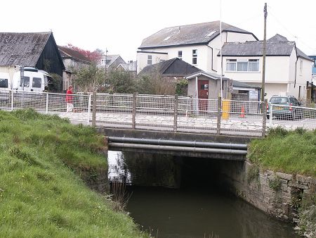
| The third obvious railway artefact that remains is the bridge
that carried the line to Padstow, and a siding, over the stream that flows into
the River Camel just here. In days gone by this channel was used to take small
vessels to the quay that was immediately on the other side of the bridge where
the corrugated iron building is today. With the roadway now narrowed as it
leads into a supermarket car park, the far side was the running line and the
near side the siding. |
 |
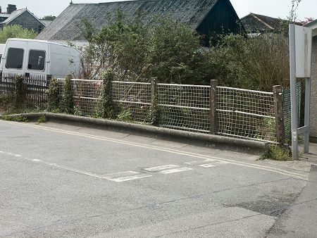 |
Typical of railway architecture, and displaying their Exmouth
Junction Concrete Works heritage, the bridge railings have gained a metal mesh
to protect the pedestrians who use the bridge these days. It is hard to imagine
that this site was once the domain of the mighty Bulleid pacifics, the
workaholic class Ns and the elegant class T9s! |
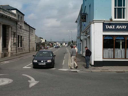
| Even harder to imagine is that this site was once both a road
and a railway. The lefthand half of today's Eddystone Road was its
entirety, with the railway line to Padstow and the Town Quay in the middle of
the righthand side of the roadway, and a footpath beside the buildings in
virtually the same position as today. Fences were provided on either side of
the line to keep people off the railway, and immediately in front of where you
see the car was the level crossing that could cause some delightful traffic
chaos in the 1950s and 60s!
In the distance can be seen some white buildings, which is where the Camel
Trail re-starts for the leg to Padstow. The horizontal structure above these is
the Camel Bridge, an ungainly modern structure that takes the A39 around the
town and high above the River Camel, thus providing much needed congestion
relief for the town centre that would have been so useful in the days of the
level crossing.
|
 |
|