The North Cornwall Railway
OTTERHAM since closure
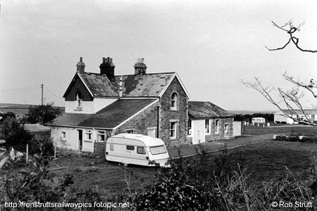 |
Back to stone buildings again, Otterham station in 1985, with
the station house lived in and the station area converted into a caravan and
camping site. This photograph of the platform side of the main station building
was taken by Ron Strutt. |
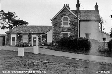
| This view, also by Ron Strutt in
1985, shows the front of the station buildings |
 |
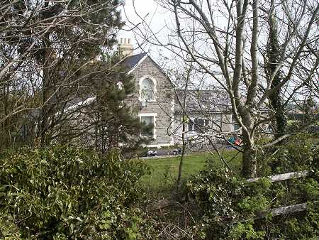 |
Otterham station as it is today, used as a private residence
whilst the station yard area has had a small development of prefabricated homes
built on it. The A39 overbridge was demolished when the road was straightened
and widened but the area around the station is still known as Otterham
Station. |
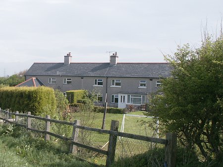
| The line of ex-railway cottages at Otterham. They were built on
the stub of a road (that became the B3262) that was diverted from its original
alignment when the railway was first built. |
 |
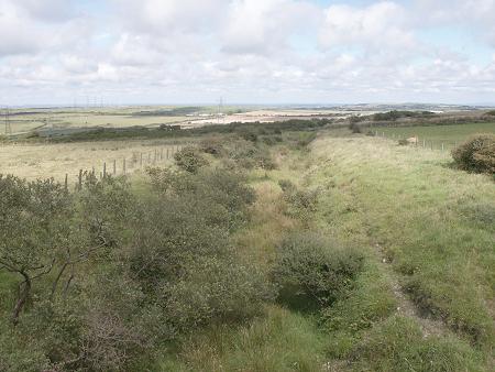 |
A mile beyond Otterham station the line passed under the minor
road leading to Lesnewth by means of bridge 89. The bridge and the course of
the railway line are still in situ, though the cutting that the railway ran in
is now very overgrown. This is the view towards Otterham.
A little way out of the photo on the lefthand side is the home of the
photographer, though as this wasn't built until the year 2000 no-one would
have sat in the garden watching the drifting smoke as the trains ran by in
their cutting.
|
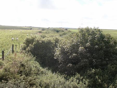
| This is the view from the other side of the bridge, looking
towards Camelford. This cutting was at the summit of the line, at an altitude
of some 860 feet, and once the line left the cutting it began the descent down
to sea level.
Just after these photographs were taken a farmer's wife, passing by in a
tractor, stopped for an enquiry as to what we were interested in. A very short
reminisce about the railway followed with, as a final comment before having to
move on due to an oncoming car, the information: "didn't need to wear
a watch to know the time back then!"
|
 |
|