The North Cornwall Railway

 
History Construction Operation Traffic The Final Years Rolling Stock Since Closure The ACE Links

PORT ISAAC ROAD TO WADEBRIDGE

Leaving Port Isaac Road the line wound round to the right on a 30 chain radius curve, and falling at a 1 in 73 gradient, into Trelill tunnel, which was some 333 yards long. Leaving the tunnel the character of the line changed with far less sharp curvature but still falling at a ruling gradient of 1 in 73. This eased to 1 in 330 as the line ran into St Kew Highway station, now just 250 feet above sea level and 40m 4ch from Halwill Junction.

St Kew Highway diagram
Diagram based on one in An Illustrated History of the North Cornwall Railway and reproduced by kind permission of Irwell Press.

St Kew Highway
The view along the station in the up direction as seen from between the tracks in 1963.
Photograph by John Bradbeer

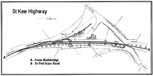
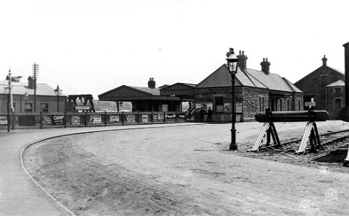
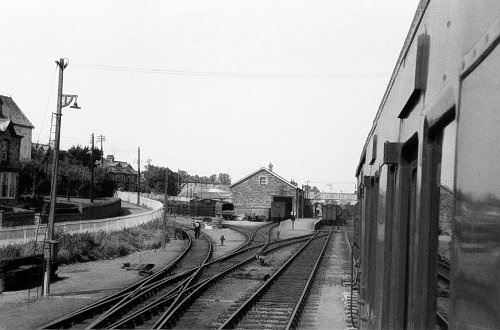
St Kew Highway station (link to map of station area) was about two miles as the crow flies St Kew village, though after the railway arrived quite a number of properties were built around a public house that was near to the station in the village of St Kew Highway. Other villages in the locality were St Tudy and St Breward, approximately two and a half and six miles away. The station was useful to the railway as it conveyed passengers for Polzeath, St Minver and Rock, putting the station on the Atlantic Coast Express' calling list.

St Kew Highway Luggage Label

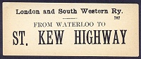
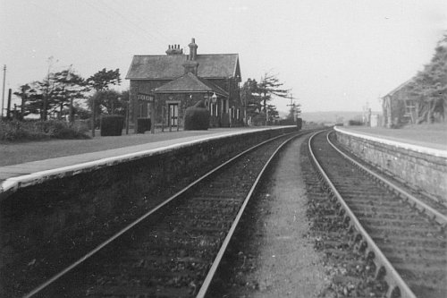
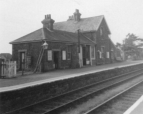
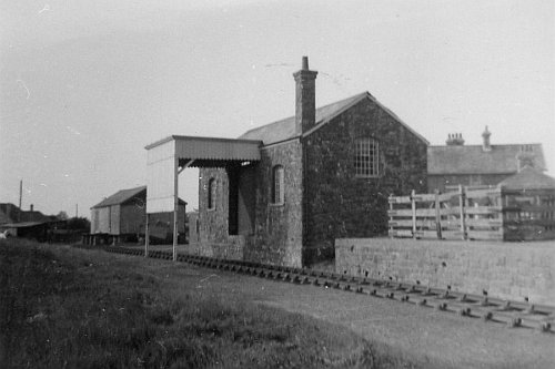
Right: A LSWR luggage label reproduced with thanks from the Mike Morant collection.

The layout at St Kew Highway was very similar to that at Port Isaac Road, though the approach road was far shorter and the shunting difficulties slightly less, especially after small amendments to the layout and signalling in 1914 and 1939. Goods traffic handled here included incoming coal and fertilizer and outgoing sugar beet, corn, pigs and the inevitable rabbits. The inroads made by road transport took a big toll on St Kew Highway which, like Port Isaac Road, lost its stationmaster in 1927 and came under the supervision of Camelford. As elsewhere, the goods yard closed in 1964 and, together with the Signalbox, was taken out of use on 21 November 1965.

St Kew Highway
A closer view of the station buildings which, as with most of the NCR stations, were on the up platform.
Photograph by John Bradbeer

St Kew Highway
The goods shed at St Kew Highway with the canopy that was a regular feature of the area.
Photograph by John Bradbeer

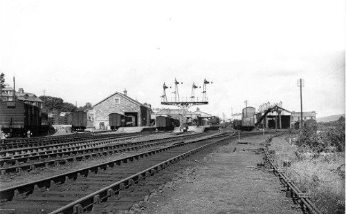
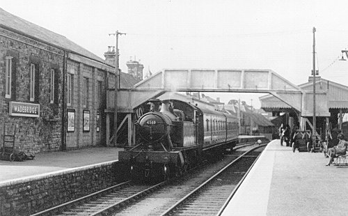
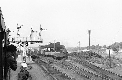
Leaving St Kew Highway the line started its final descent towards sea level at 1 in 75, curving first one way and then the next to join the Allen valley, though some way above the river, some 41 miles from Halwill. About a mile later the line passed through a rock cutting just beyond Hingham, a rocky outcrop through which the route had to be blasted. As the line dropped down nearer to the river it passed Sladesbridge, then crossed the rivers Allen and Camel to arrive at a sharp 20 chain radius curve to the right leading to Wadebridge Junction. Originally the line formed a junction here with the Bodmin & Wadebridge line from Bodmin but from 1907 the route into Wadebridge was widened to allow two single lines running parallel, thus giving the impression of double track, to the new junction at Wadebridge East. From Wadebridge East it was just a short run into Wadebridge station, just 30 feet above sea level and 44m 12ch from Halwill Junction.

Wadebridge diagram
Diagram based on one in An Illustrated History of the North Cornwall Railway and reproduced by kind permission of Irwell Press.

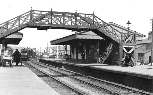
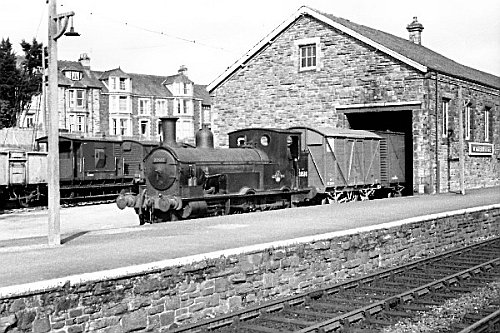
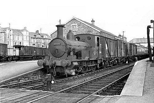
Wadebridge (link to map of station area).

Wadebridge Station in 1913
The well-known view of the approach to Wadebridge station, as it was in 1913.
Photograph reproduced by kind permission of David & Charles Ltd., Newton Abbott.

Wadebridge Station in 1913
Wadebridge station and its footbridge, photographed in 1913. This ornamental wooden footbridge
was subsequently replaced by a rather narrow concrete one! The train in the photograph is a
steam railcar for Padstow, most probably either º4 or º5.
Photograph reproduced by kind permission of David & Charles Ltd., Newton Abbott.

Wadebridge Station in 1948
As at Launceston, Wadebridge and Padstow had naming ceremonies for "their" West Country
class locomotives, both on 31st October 1945. Here 21C107 WADEBRIDGE is being
named by Cllr C H Paul, the Chairman of Wadebridge RDC.
Photograph reproduced by kind permission of Hugh Paul.

Wadebridge Station in 1961
An overview of Wadebridge station from the London end, photographed in 1948.
Photograph reproduced by kind permission of David & Charles Ltd., Newton Abbott.

Wadebridge Station in 1958
Two of the famous Beattie Well Tanks, 30585 and 30586, outside the Wadebridge engine
shed on 13th September 1958.
Photograph reproduced by kind permission of Joanes Publications.

Wadebridge Station in 1958
Back under Southern Region control, though featuring a Western Region train, small prairie
tank º4569 was working a train to Bodmin Road via General on 13th September 1958.
Photograph reproduced by kind permission of Joanes Publications.

Wadebridge Station in 1948
N Class º31839 with a goods train at Wadebridge during August 1960. There are no
fewer than four cranes in view in this photograph.
Photograph © Geoff Ward.

Wadebridge Station in 1948
The down side of Wadebridge station on 30th August 1961. Just for a change there is no
Beattie well tank shunting outside the goods shed!
Photograph © Chris Knowles-Thomas.

Wadebridge Station in 1961
The up side of Wadebridge station on 30th August 1961 with a D63XX diesel on a service to
Bodmin and a Southern mogul in the yard. Note that flat-bottom rail has been laid on the bay
platform road.
Photograph © Chris Knowles-Thomas.

Wadebridge Station in 1948
A far more normal view of the goods shed with a Beattie well tank, º30586, in attendance!
Photograph: Mike Morant collection.

Wadebridge Station in 1961
Now º30586 is in the platform road, presumably about to detach vans from the rear of a
down train. A shunter appears to be uncoupling, the Guard is waiting to place the tail
lamp on the remaining stock and the dummy is off for the loco and vans to proceed.
Photograph: Mike Morant collection.

Wadebridge Carriage Window Label

A window label that would be affixed to the droplight of a carriage door to advise passengers of the destination of that particular carriage.

Return to top

Halwill to Tower Hill.
Tower Hill to Launceston.
Launceston to Otterham.
Otterham to Port Isaac Road.
Port Isaac Road to Wadebridge.
Wadebridge to Padstow.
 
History Construction Operation Traffic The Final Years Rolling Stock Since Closure The ACE Links

E-mail: