The North Cornwall Railway
OTTERHAM TO PORT ISAAC ROADLeaving Otterham the surrounding countryside was much more open as the line skirted Bodmin Moor and, one mile to the west of the station, crested a 1 in 73 gradient at its summit of 860ft and started the drop down to the sea. The need to serve the geat quarry at Delabloe kept the railway above the easy route down the River Camel valley and it followed the contours sharply to the final descent at 1 in 80 to Camelford station, about 770ft above sea level and some 30m 76ch from Halwill Junction.
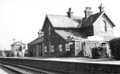
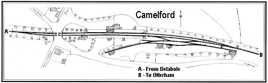
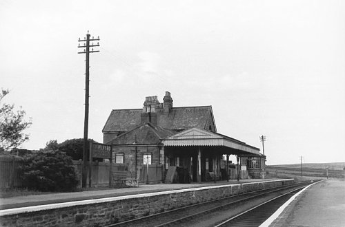
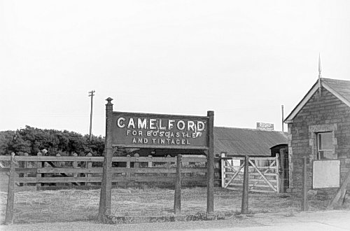
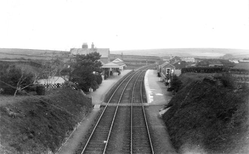
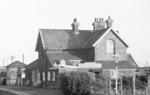
Camelford station (link to map of station area) was the only one between Halwill and Wadebridge to be given a platform awning, though only for the up direction! Originally an important station, with an hotel (though a history of fires and rebuilding clouded this) nearby until 1917, Camelford station was, due to the need to take the line through Delabole, some 1½ miles from the town it served. In the early years a horse bus took pasengers to and from the town centre and until 1920 the LSWR subsidised another from Boscastle and Tintagel. Motor buses then took over the routes, first operated by local concerns and then from 1930 by the Southern National Bus Company, in whom the Southern Railway had a shareholding. The SN route 122 (subsequently Western National route 322) from Bude to Wadebridge fulfilled requirements, comprehensively visiting many small villages along the way to connect them with the station. This ran until privatisation of bus companies and lives on today in the form of the Western Greyhound route 594, now extended as far as Truro. Boscastle and Tintagel both provided a lot of traffic for Camelford station, especially so after the building of the big King Arthur's Castle Hotel at the latter in 1899. Camelford itself, though with a population of some 2,000, was not well regarded in the late nineteenth century and the new road from Launceston to Bodmin had passed nowhere near. The railway, though, saw the town differently with a further plus point being the well-populated catchment area to the south bringing the area population up to about 7,000. The Duke of Beford was a large land owner and the town had a Grammar School. 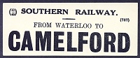
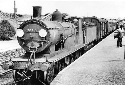
Left: A Southern Railway luggage label reproduced with thanks from the Mike Morant collection. Camelford also had a light pacific, º21C132, (later 34032,
see photo at Halwill above) named after it but there was no naming ceremony for
this locomotive. One of her nameplates is, however, to be found in Camelford
today.
Leaving Camelford the line twisted and turned again, just as it had near Tresmeer, following the contours down to the quarry at Delabole, then levelling as it ran under a road bridge and into Delabole station, some 650 feet above sea level and 33m 25ch from Halwill Junction.
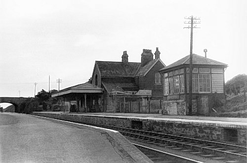
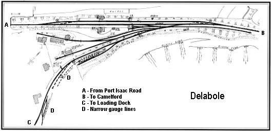
Delabole station (link to map of station area) served the great slate quarry nearby, which in turn provided employment for hundreds of men, and the hamlets of Rockhead, Medrose, Pengelly and Higher Pengelly, better known these days simply as Delabole. The railway and the quarry were very important to each other - after the line opened the quarry's output rose considerably (though not immediately), which in turn provided traffic and revenue for the railway. The quarry came right up to the edge of the goods yard, which caused the LSWR some concern, though the Slate Company assured the railway that it was safe and no unfortunate event proved them wrong. The loading facilities were provided for the Slate Company by the LSWR rather than the NCR, as was a siding to the Trebarwith quarries. The slates were packed into 10 ton wagons, with plenty of straw for protection, and before the First World War left Delabole in whole trainloads. Demand for slate started its decline after this war as clay, then in recent times concrete, was cheaper and more popular for roofing. There was at one time an engine shed and 50' turntable but the shed was sold to the Delabole Co-operative Society for £20 in 1912, who moved it slightly and used it as a corn store. The turntable was removed. The loops were extended in 1911 to accomodate 12 coach or 32 wagon trains 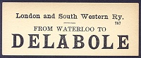
Right: A LSWR luggage label reproduced with thanks from the Mike Morant collection.
Leaving Delabole the line twisted and turned through a series of 30 and 40 chain reverse curves, falling at a fairly constant gradient of between 1 in 73 and 1 in 88 to Port Isaac Road, some 400 feet above sea level and 37m 33ch from Halwill Junction. Two miles from Delabole station was a bridge where the road to St Teath, about one mile distant, passed over the line and at this point the villagers of St Teath would have preferred to have had the station, but Delabole was the chosen site.
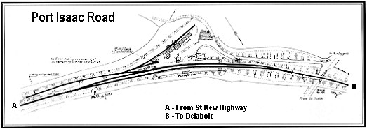
Port Isaac Road, (link to map of station area) as the name suggests, was a long way from the village it purported to serve, some four miles away! Even the station was isolated, being about a quarter of a mile from the St Teath-Pendogget road up a narrow access road. It was Port Isaac that was the reasoning for building the station, with its fish traffic and the potential for tourist traffic, with wagon loads of mackeral and shellfish depatched by overnight train to Billingsgate. Flowers and fruit were also important traffic at one time, with the early daffodils very important to the Cornish economy until the advent of low cost air freight meant they could be brought in from overseas even earlier. The station was connected to the port by horse drawn vehicles that were not replaced by buses until the 1920s. Privately operated with the aid of a subsidy from the Southern Railway, this arrangement ended in 1930 when the railway withdrew its subsidy in favour of the newly formed Southern National Omnibus Company, in which the railway was a shareholder. 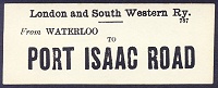
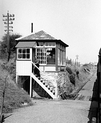
Left: A LSWR luggage label reproduced with thanks from the Mike Morant collection. Shunting the goods yard was awkward and visibility restricted by the 30 chain curvature of the line through the station so some track circuiting was provided from February 1961, quite a rarity on the North Cornwall line as the only other locations with track circuiting were Halwill Junction and the entrance to Wadebridge Quay sidings! As well as the previously mentioned fish and flowers, the station saw plenty of rabbit traffic (of course!) and also inbound fish, from Grimsby. The inevitable decline began in the 1930s (the station had lost its stationmaster in 1927, from which date it came under Camelford) until the goods yard closed on 7 September 1964.
Return to top
|
 Right:
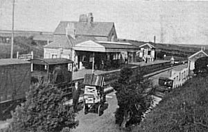
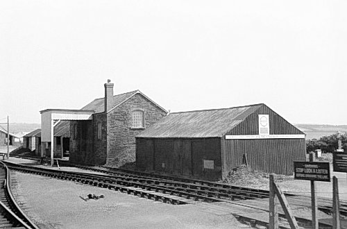
Camelford Station in 1934
Right:
Camelford Station in 1934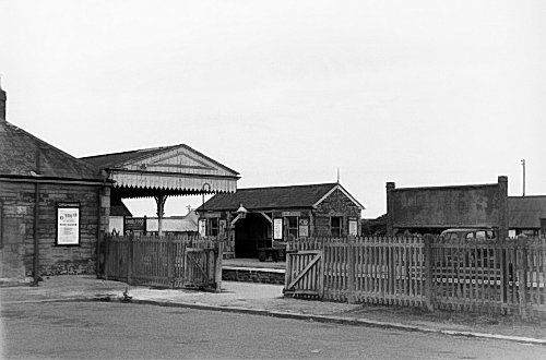
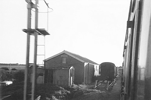
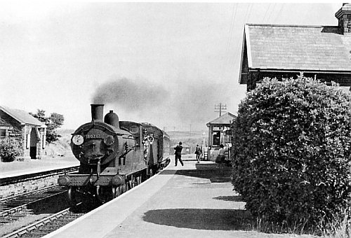
 Right: Port Isaac Road Station on 30th August 1961